|
Lake Baikal |
©EVGEN, 2008 |
||
|
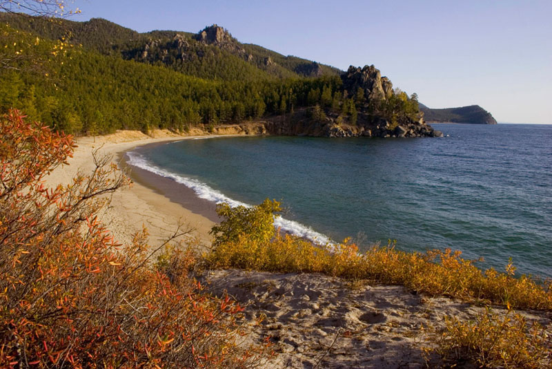
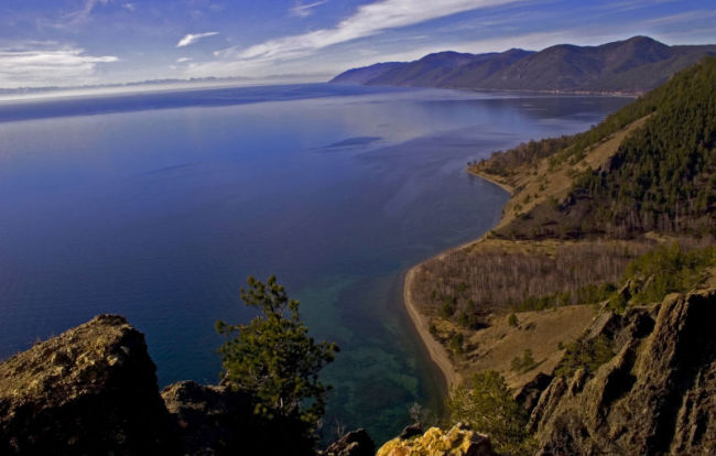
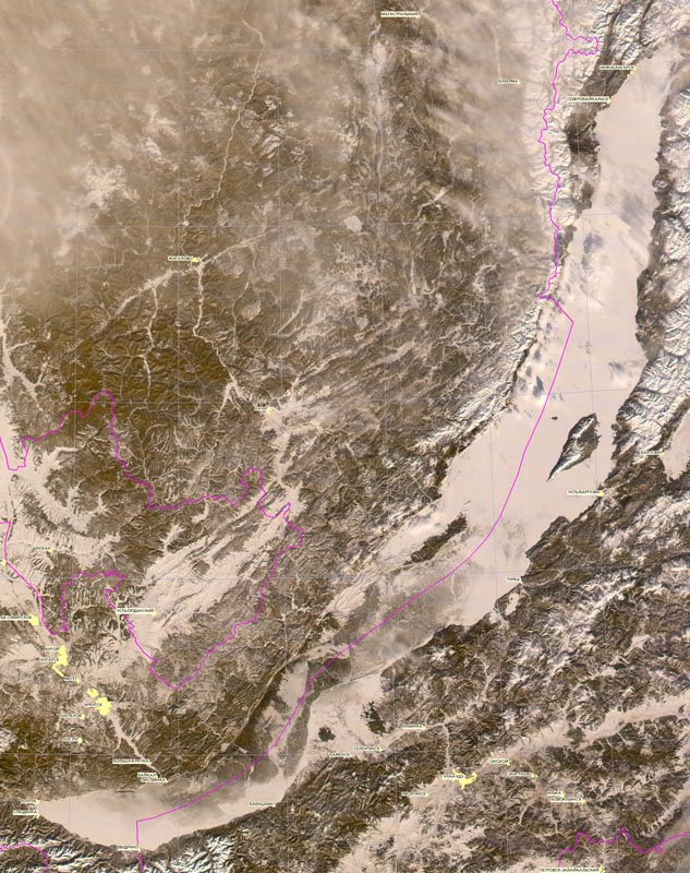
Lake Baikal is in a rift valley created by the Baikal Rift Zone, where the
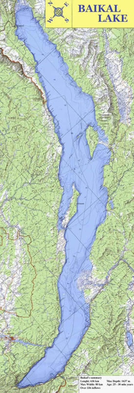
Its age is estimated at 25-30 million years, making it one of the most ancient lakes in geological history. It is unique among large, high-latitude lakes in that its sediments have not been scoured by overriding continental ice sheets. US and Russian studies of core sediment in the 1990s provide a detailed record of climatic variation over the past 250,000 years. Longer and deeper sediment cores are expected in the near future. Lake Baikal is furthermore the only confined fresh water lake in which direct and indirect evidence of gas hydrates exists. The lake is completely surrounded by mountains. The Baikal Mountains on the north shore and the taiga are technically protected as a national park. It contains 22 islands; the largest, Olkhon, is 72 kilometers long. The lake is fed by as many as three hundred and thirty inflowing rivers. The main ones draining directly into Baikal are the Selenga River, the Barguzin River, the Upper Angara River etc. It is drained through a single outlet, the Angara River, where Listvyanka is situated. Baikal's coastline stretches for over 1300 miles. Surprisingly,
wouldn't it be easier for us to imagine hundreds of thousands miles in the spatial
emptiness on the way to the moon than these thirteen hundred miles in majestic
This has to be believed as well as Baikal basin's volume does ( 5520 cubic miles, 20 percent of all freshwater on the earth surface); the depth of its bed-load deposits do ( up to 4-5 miles); the number of its water and coastline dwellers do ( hundreds and hundreds of endemic animals and plants absent anywhere else in the world); and a lot more of other things which are hard to believe. 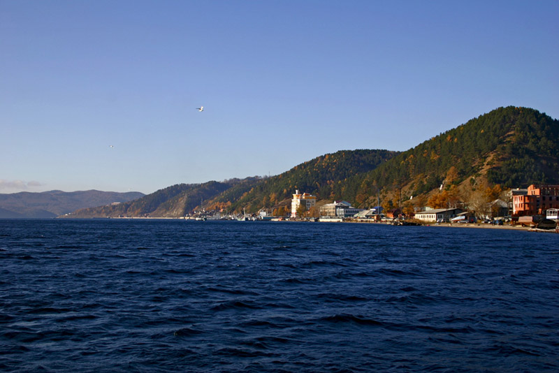
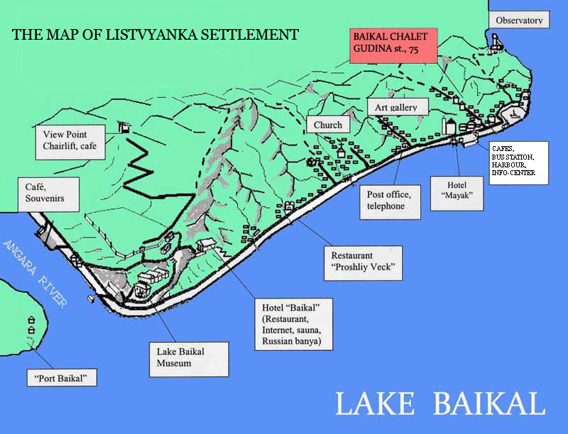
The small but tourist-wise town of Listvyanka is located on the south-western shore of Lake Baikal, 70 km from Irkutsk. Russian pioneers came to this spot in the middle of the 17th century, founded trading and military post there. The settlement grew along with the development of navigation on Lake Baikal. Many vessels were built at the Listvyanka shipyard, the British icebreakers "Baikal" and "Angara" were assembled also there. This old-style Siberian village, known as the gates to Baikal, is situated at the source of the Angara River, the only outflow of the deepest lake. From the 18th century a ferry took merchants across the lake on their way to the north, Mongolia, China and the Far East. The population of the town is about 2,300 people, mostly employed in human services. Despite its modest size Listvyanka is one of the busiest tourist centers in Siberia. Due to its proximity to Irkutsk, it sees probably more visitors than all other towns and villages on Lake Baikal combined - particularly on the weekends when crowds of Russian and Western tourists visit the settlement. Listvyanka has a developed tourist infrastructure: a museum, chairlift to the city viewpoint, information center, boat jetty, art gallery, tourist-oriented market, picnic areas, several hotels and a plenty of restaurants and cafes. The main part of the tourist fleet of the lake moor in the town. Thanks to the large number of sunny days in Listvyanka, there is Solar Observatory with 4 telescopes, located on the northern cape of the settlement. Listvyanka is the site of the Limnological Institute of the Russian Academy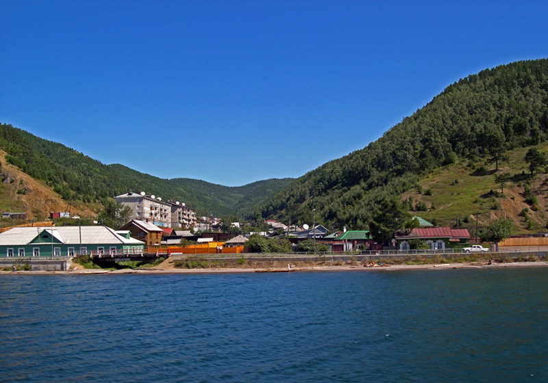 of Sciences. It studies the lakes and man-made reservoirs of Siberia and the
Russian Far East, with particular focus on Lake Baikal. The institute has a
small but very interesting museum of the Baikal's flora and fauna.
of Sciences. It studies the lakes and man-made reservoirs of Siberia and the
Russian Far East, with particular focus on Lake Baikal. The institute has a
small but very interesting museum of the Baikal's flora and fauna.
To get to Listvyanka from Irkutsk you need to get to the bus
station of Irkutsk city. The regular public bus leaves at 9.00am, 2.30pm, 4.00pm and 7.00pm.
There are also minibuses taking people to Listvyanka, departing from the station
every 30-40 minutes. You need to find platform #3 and the bus with the blue lake Baikal
sign and "Listvyanka" on it. Or you may just ask for "Listvyanka ??" and follow the
directions.
| |||
 |
||||
| "Baikal Chalet Listvyanka", booking tel/fax: +7 3952 46-15-57, mobile: +7 914 8 951 961, address: Gudina str. 75, Listvyanka, Irkutsk region, Russia
e-mail: travel@angara.ru, SkyPe : Youry Nemirovskiy |
||||